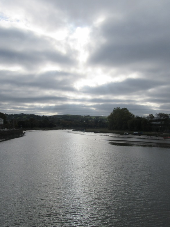
Bolstered by our success of doing a “half day” walk in a day using public transport from Exeter, 2 days later we came back to do the next one, pausing to take in the sky from Barnstaple bridge on our way from the train station to the bus station.


The start was a bit shakey. As we came into the edge of Woolacombe on the bus, we saw a sign for the SWCP Woolacombe via Mortehoe. It wasn’t the way we’d gone, and The Boy was worried we’d gone wrong, but I quickly explained it was an alternative route and we’d definitely gone the right way last time. Once in Woolacombe we had 15 mins to kill before the chip shop opened and we went and admired the view of the start of the days route along Woolacombe Beach towards Baggy Point, said hi to a clearly visible Lundy, and double checked the signs for the path. He once again became convinced we’d walked the wrong way, (across the grass and through the car park next to the pavement, rather than along it). He insisted we started to retrace our steps but luckily we came across some random strangers out walking and after a few hints dropped from me they confirmed that we’d definitely come the right way last time and we were allowed to go and buy some lunch. Phew.
Finally, with chips in hand it was time to start the walk proper. Here there was another problem, the guide book suggested not one but three routes (including the beach, which I rather fancied as it was low tide). However my walking companion decided that the route through the dunes was the official one and so that’s the way we went, mere fleeting views of the sea be damned.
Turns out that my brainwave of chips whilst strolling was not so good when my son didn’t spot a huge hole (dug by a dog maybe) and fell dropping chips everywhere. However his decision was pretty good as I actually found walking through the dunes interesting, even if I couldn’t see much of the sea.
It was still quite sandy and slow going, but before too long we were nearing the far end of the (very long) beach and took a turn up and onto a track, so heading up to the ridge of that heads out to Baggy Point. We got a good view down to Puttsborough sands and could see back the way we’d come to Morte Pt and beyond, which we presumed was Bull Pt.
It wasn’t far onto Baggy Point (even with my companion insisting on going through the dog gates) where we found a mysterious post that we later discovered was a coast guard look out back in the day. Looking back we because increasingly convinced that what we originally thought was Bull Point was in fact Wales, which seemed odd, as the day was greyer than 2 days before so it felt like we couldn’t see as far. We could definitely see Lundy out in the bay and we could also now see Croyde, the mouth of the, Barnstaple/Bideford estury and on round the bay to Hartland Pt and started heading inland.
Then disaster, we met up with the coast path. Turns out we should have gone walked towards the edge more at baggy pt and found the path that comes lower around the headland. I tried to sit on the bench and have some peace and quiet and send the boy back on his own (there were loads of people and families about walking to Baggy pt from Croyde), but he texted me that I had to come see the spectacular view, and yes, when you went the right way there was a nice view of some rocks.
We picked up some postcards in the national trust car park and had a pit stop at a cafe, before going on into Croyde and over the beach (officially, phew).
We were making good time, so decided to go round the next headland, passing some specutacular looking rocks and a gun post, which the boy went to explore whilst I spoke to a local who confirmed that we could indeed see the Gower Peninsular today and also Lundy, although he said it would “trolley off” later doubtless.
We passed what we think was the old coastguard building, which appeared to be getting done up, and then nearly missed the path as you had to cross the main road and then double back on yourself slightly to get onto it. It was a few metres in from the road and several up as the hillside was steep. The views were great but we didn’t have time to stop as the next bus was due soon. We made it to the Saunton Hotel with a couple of minutes to spare before the bus and felt very smug with ourselves that we’d done a bit extra than planned.
This time we did see the sunset in Barnstaple (but no photo’s) and got the train home an hour earlier than the previous trip, much more civilised!
The path between Croyde and Westwood Ho! is never very far from the 21 bus route, which also goes to the station in Barnstaple, so we hope to get in a few more day trips and finish our first “weeks” walking.


![IMG_0228[1].JPG](https://prolificprojectstarter.files.wordpress.com/2018/11/img_02281.jpg?w=585)
![IMG_0234[1] IMG_0234[1]](https://prolificprojectstarter.files.wordpress.com/2018/11/img_02341.jpg?w=289&resize=289%2C385&h=385#038;h=385)
![IMG_0235[1] IMG_0235[1]](https://prolificprojectstarter.files.wordpress.com/2018/11/img_02351.jpg?w=288&resize=288%2C385&h=385#038;h=385)
![IMG_0236[1] IMG_0236[1]](https://prolificprojectstarter.files.wordpress.com/2018/11/img_02361.jpg?w=224&resize=224%2C299&h=299#038;h=299)
![IMG_0237[1] IMG_0237[1]](https://prolificprojectstarter.files.wordpress.com/2018/11/img_02371.jpg?w=224&resize=224%2C168&h=168#038;h=168)
![IMG_0238[1] IMG_0238[1]](https://prolificprojectstarter.files.wordpress.com/2018/11/img_02381.jpg?w=353&resize=353%2C471&h=471#038;h=471)
![IMG_0243[1].JPG](https://prolificprojectstarter.files.wordpress.com/2018/11/img_02431.jpg?w=5184)
![IMG_0246[1]](https://prolificprojectstarter.files.wordpress.com/2018/11/img_02461.jpg?w=585)
![IMG_0249[1] IMG_0249[1]](https://prolificprojectstarter.files.wordpress.com/2018/11/img_02491.jpg?w=289&resize=289%2C385&h=385#038;h=385)
![IMG_0250[1] IMG_0250[1]](https://prolificprojectstarter.files.wordpress.com/2018/11/img_02501.jpg?w=288&resize=288%2C385&h=385#038;h=385)
![IMG_0251[1] IMG_0251[1]](https://prolificprojectstarter.files.wordpress.com/2018/11/img_02511.jpg?w=581&resize=581%2C436&h=436#038;h=436)
![IMG_0256[1] IMG_0256[1]](https://prolificprojectstarter.files.wordpress.com/2018/11/img_02561.jpg?w=208&resize=208%2C277&h=277#038;h=277)
![IMG_0257[1] IMG_0257[1]](https://prolificprojectstarter.files.wordpress.com/2018/11/img_02571.jpg?w=369&resize=369%2C277&h=277#038;h=277)
![IMG_0264[2] IMG_0264[2]](https://prolificprojectstarter.files.wordpress.com/2018/11/img_02642.jpg?w=289&resize=289%2C385&h=385#038;h=385)
![IMG_0265[1] IMG_0265[1]](https://prolificprojectstarter.files.wordpress.com/2018/11/img_02651.jpg?w=288&resize=288%2C385&h=385#038;h=385)
![IMG_0271[1] IMG_0271[1]](https://prolificprojectstarter.files.wordpress.com/2018/11/img_02711.jpg?w=369&resize=369%2C277&h=277#038;h=277)
![IMG_0269[1] IMG_0269[1]](https://prolificprojectstarter.files.wordpress.com/2018/11/img_02691.jpg?w=208&resize=208%2C277&h=277#038;h=277)
![IMG_0270[1] IMG_0270[1]](https://prolificprojectstarter.files.wordpress.com/2018/11/img_02701.jpg?w=119&resize=119%2C159&h=159#038;h=159)
![IMG_0273[2] IMG_0273[2]](https://prolificprojectstarter.files.wordpress.com/2018/11/img_02732.jpg?w=119&resize=119%2C159&h=159#038;h=159)
![IMG_0274[1] IMG_0274[1]](https://prolificprojectstarter.files.wordpress.com/2018/11/img_02741.jpg?w=212&resize=212%2C159&h=159#038;h=159)
![IMG_0275[1] IMG_0275[1]](https://prolificprojectstarter.files.wordpress.com/2018/11/img_02751.jpg?w=119&resize=119%2C159&h=159#038;h=159)
![IMG_0282[1] IMG_0282[1]](https://prolificprojectstarter.files.wordpress.com/2018/11/img_02821.jpg?w=270&resize=270%2C203&h=203#038;h=203)
![IMG_0281[1] IMG_0281[1]](https://prolificprojectstarter.files.wordpress.com/2018/11/img_02811.jpg?w=270&resize=270%2C202&h=202#038;h=202)
![IMG_0288[1] IMG_0288[1]](https://prolificprojectstarter.files.wordpress.com/2018/11/img_02881.jpg?w=307&resize=307%2C409&h=409#038;h=409)
![IMG_0291[1] IMG_0291[1]](https://prolificprojectstarter.files.wordpress.com/2018/11/img_02911.jpg?w=289&resize=289%2C385&h=385#038;h=385)
![IMG_0294[1] IMG_0294[1]](https://prolificprojectstarter.files.wordpress.com/2018/11/img_02941.jpg?w=288&resize=288%2C385&h=385#038;h=385)
![IMG_0297[1] IMG_0297[1]](https://prolificprojectstarter.files.wordpress.com/2018/11/img_02971.jpg?w=369&resize=369%2C277&h=277#038;h=277)
![IMG_0312[1] IMG_0312[1]](https://prolificprojectstarter.files.wordpress.com/2018/11/img_03121.jpg?w=208&resize=208%2C277&h=277#038;h=277)
![IMG_0313[1] IMG_0313[1]](https://prolificprojectstarter.files.wordpress.com/2018/11/img_03131.jpg?w=581&resize=581%2C775&h=775#038;h=775)
![IMG_0314[1] IMG_0314[1]](https://prolificprojectstarter.files.wordpress.com/2018/11/img_03141.jpg?w=369&resize=369%2C277&h=277#038;h=277)
![IMG_0326[1] IMG_0326[1]](https://prolificprojectstarter.files.wordpress.com/2018/11/img_03261.jpg?w=208&resize=208%2C277&h=277#038;h=277)
![IMG_0318[1] IMG_0318[1]](https://prolificprojectstarter.files.wordpress.com/2018/11/img_03181.jpg?w=581&resize=581%2C775&h=775#038;h=775)
![IMG_0334[1] IMG_0334[1]](https://prolificprojectstarter.files.wordpress.com/2018/11/img_03341.jpg?w=386&resize=386%2C290&h=290#038;h=290)
![IMG_0349[1] IMG_0349[1]](https://prolificprojectstarter.files.wordpress.com/2018/11/img_03491.jpg?w=191&resize=191%2C143&h=143#038;h=143)
![IMG_0357[1] IMG_0357[1]](https://prolificprojectstarter.files.wordpress.com/2018/11/img_03571.jpg?w=191&resize=191%2C143&h=143#038;h=143)
![IMG_0362[1] IMG_0362[1]](https://prolificprojectstarter.files.wordpress.com/2018/11/img_03621.jpg?w=386&resize=386%2C290&h=290#038;h=290)
![IMG_0364[1] IMG_0364[1]](https://prolificprojectstarter.files.wordpress.com/2018/11/img_03641.jpg?w=191&resize=191%2C143&h=143#038;h=143)
![IMG_0360[1] IMG_0360[1]](https://prolificprojectstarter.files.wordpress.com/2018/11/img_03601.jpg?w=191&resize=191%2C143&h=143#038;h=143)
![IMG_0387[1] IMG_0387[1]](https://prolificprojectstarter.files.wordpress.com/2018/11/img_03871.jpg?w=369&resize=369%2C277&h=277#038;h=277)
![IMG_0401[1] IMG_0401[1]](https://prolificprojectstarter.files.wordpress.com/2018/11/img_04011.jpg?w=208&resize=208%2C277&h=277#038;h=277)
![IMG_0402[1] IMG_0402[1]](https://prolificprojectstarter.files.wordpress.com/2018/11/img_04021.jpg?w=581&resize=581%2C775&h=775#038;h=775)
![IMG_0416[1].JPG](https://prolificprojectstarter.files.wordpress.com/2018/11/img_04161.jpg?w=5184)


